ham14er Event from Telluride
Last August I was a new father with an 8 week-old going up Tower Mountain. This year I’m now the proud father of a 14 month-old, which turns out to be just as much work or perhaps even moreso than having an infant.
We found ourselves in Telluride this year, for what’s turning into an annual trip to the San Juans as a family with my in-laws, and it again coincided with the annual ham14er event. I looked at a map and found a nice string of SOTA summits, and did a bit of research to see that they have been hiked in a row before. I didn’t want to abandon my wife with the toddler to drive to a trailhead for an overnight start, so I cleared out Saturday to be gone all day. I did convince her to drive me as close to Ophir Pass as our little SUV could make it before dawn, however.
She woke up before me (angel that she is) to make coffee, then drove me a couple miles from the town of Ophir before the road turned to scree. I got out just before 6am and watched her drive away, with plans to meet up back in Telluride in the afternoon. I was a couple miles and about a thousand virt below the pass, but given the hour I didn’t expect any jeeps to hitch a ride with so I started up the road.
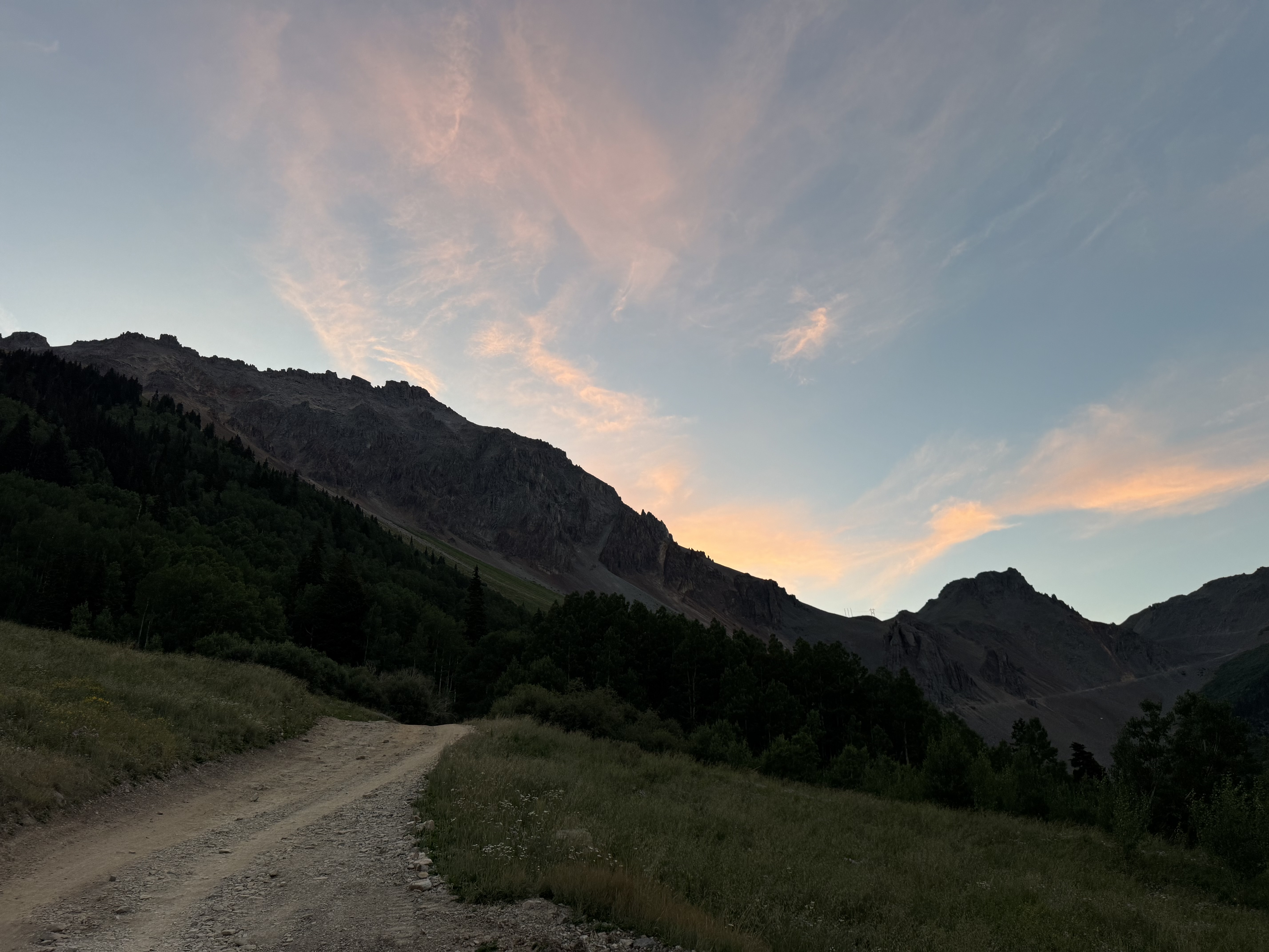
Dawn breaking on the road up Ophir Pass
As I slowly hiked up, I passed through the narrow squeezes that I recall driving in the truck not so long ago, and the wildflowers were in bloom over the small town of Ophir.
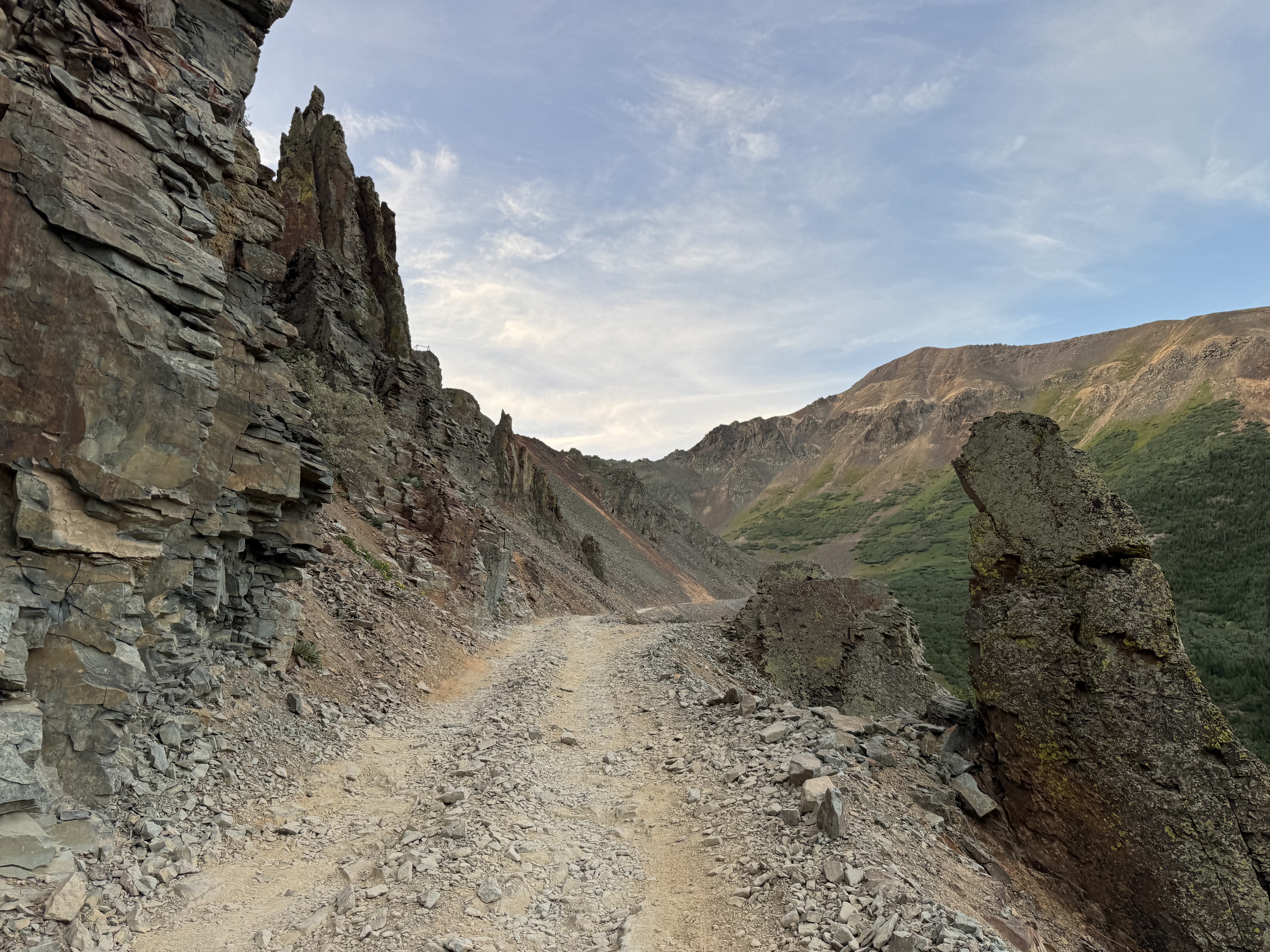
I reached the pass just before 7am. From here, my plan was to head straight up to Lookout Mountain W0C/SJ-041, a 10-point summit that has never been activated before. I immediately got off trail, following a social trail from the pass when the proper trail starts a couple hundred yards downhill on the 550 side. No big deal.
I moved over scree fields, passed old mining ruins, and generally made my way towards the mountain. Eventually I found a cairn, and rejoined the trail.
When I rejoined the trail, the mountain loomed above. There was no obvious way up, so I was happy to follow the route someone else had laid before me.
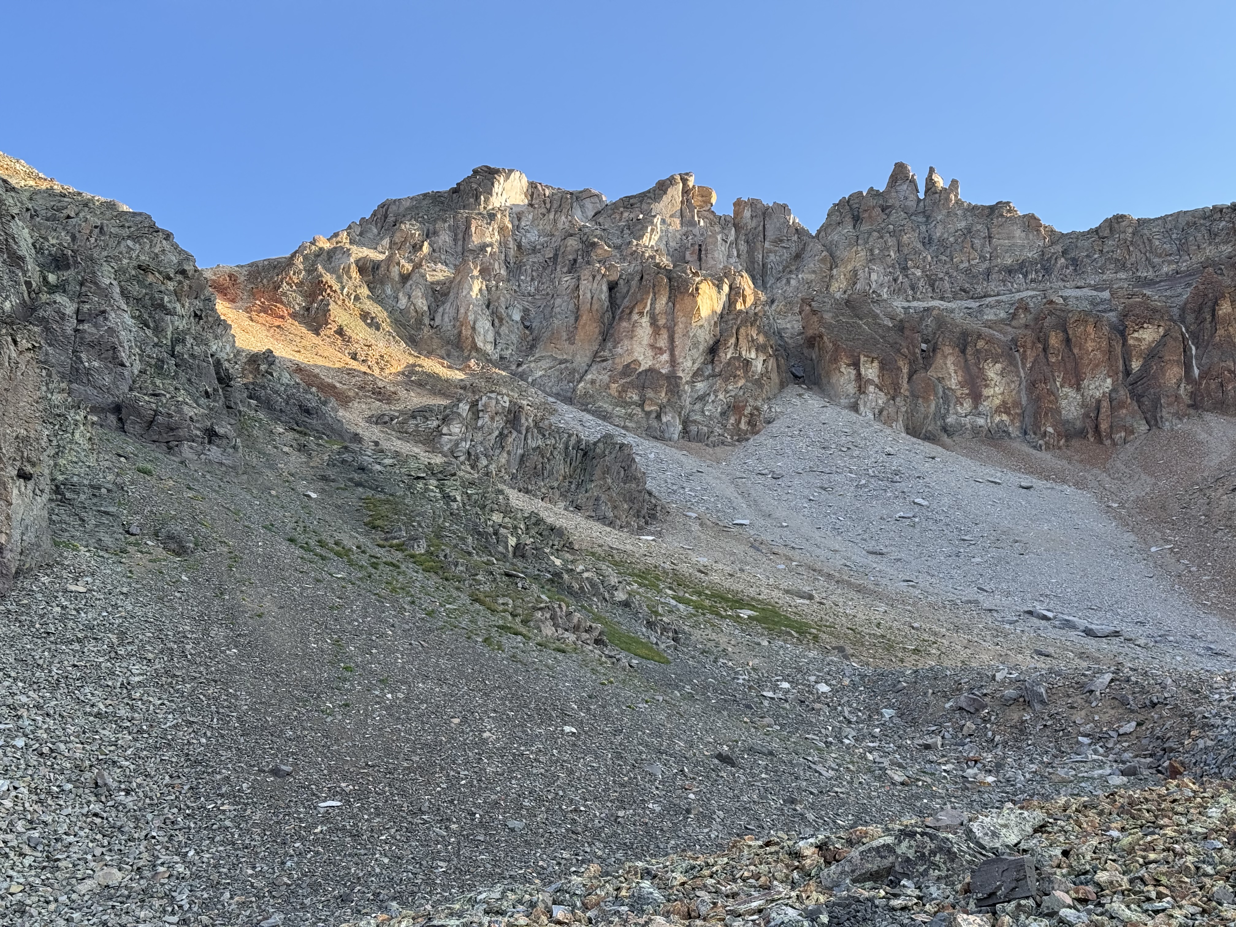
Lookout Mountain from below
Eventually the trail had some very low third class to navigate, but I gained the summit. The trail up Lookout from Ophir Pass is not for the faint of heart, but it’s not technical in any meaninful way. The hard part is gaining so much elevation in such a short distance, it feels like climbing a ladder at some points.
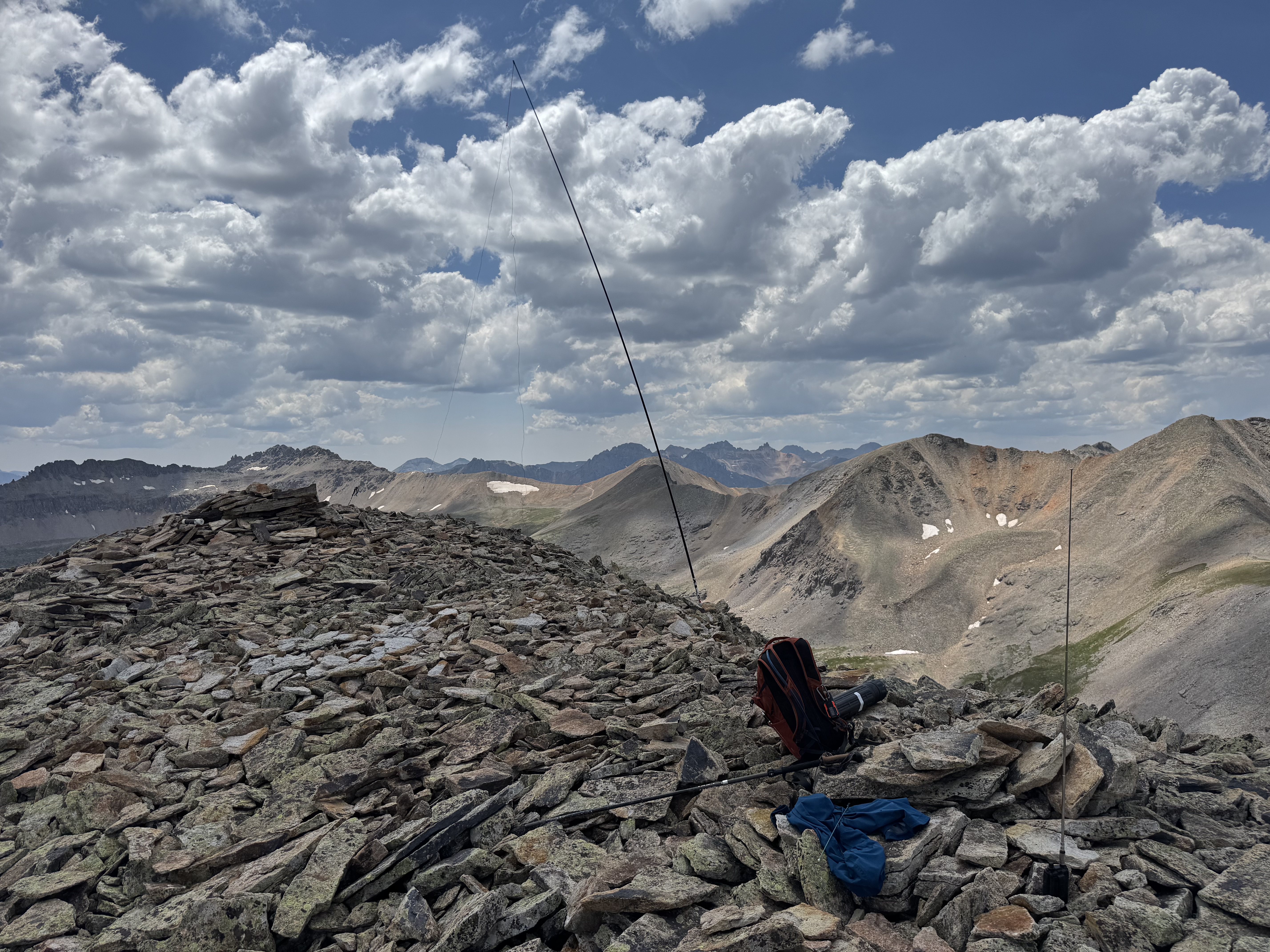
At the summit, I immediately got on 2m with my HT and had no luck. It was just 8:30am and most other parties would be summiting closer to 10am, so rather than sit around I threw up the HF radio and set up on 20m.
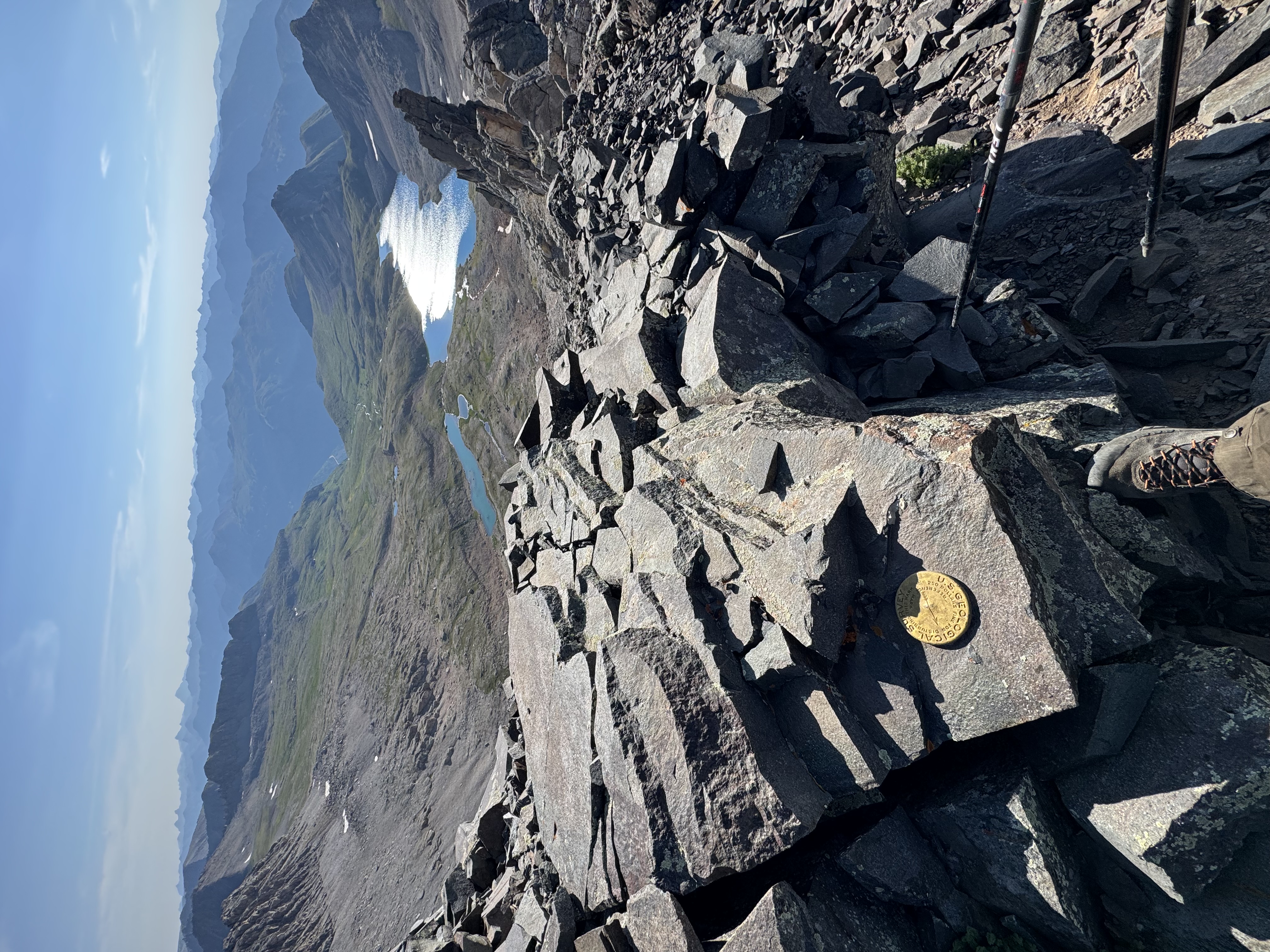
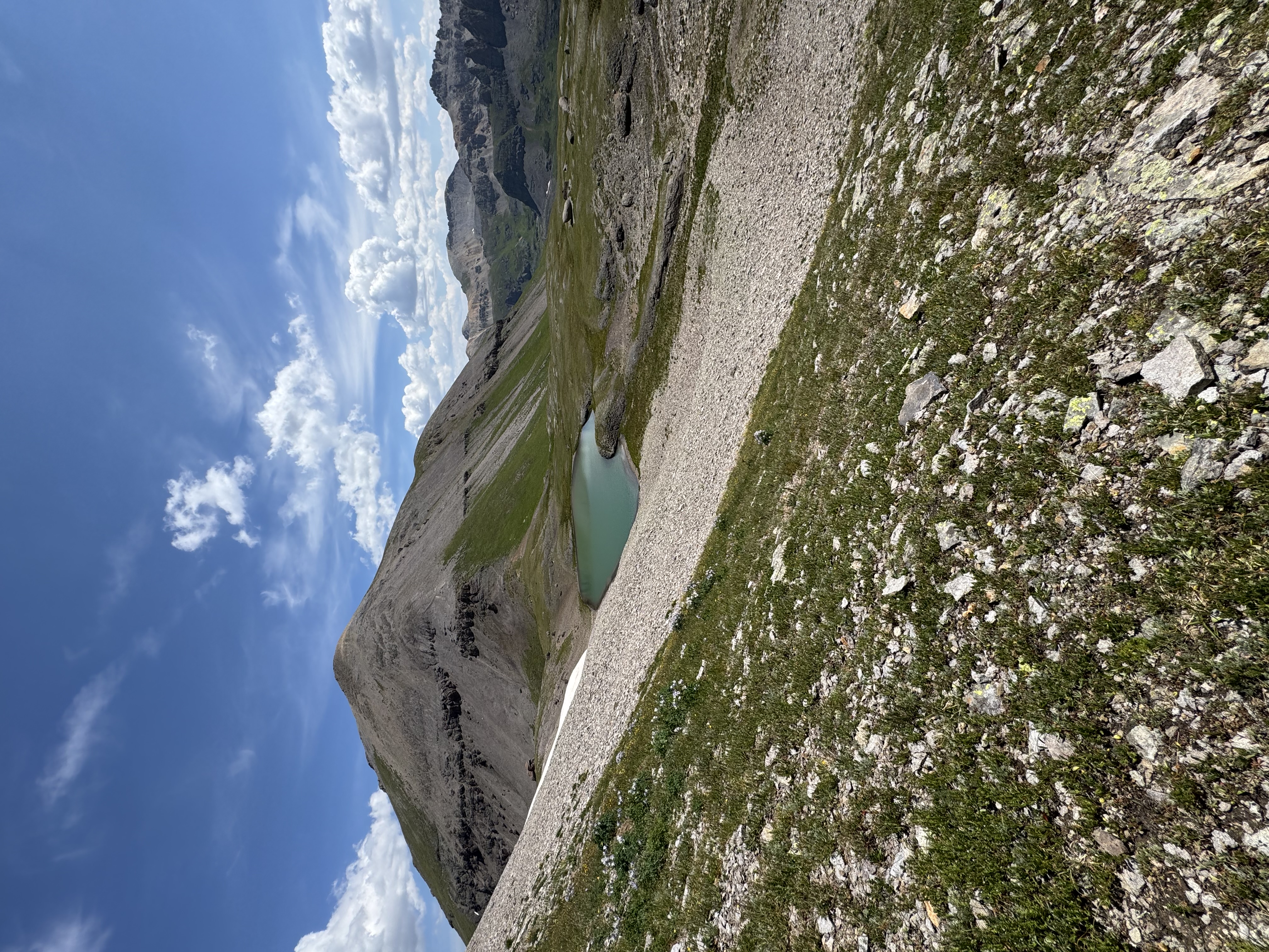
Columbine Lake and a marker near the summit
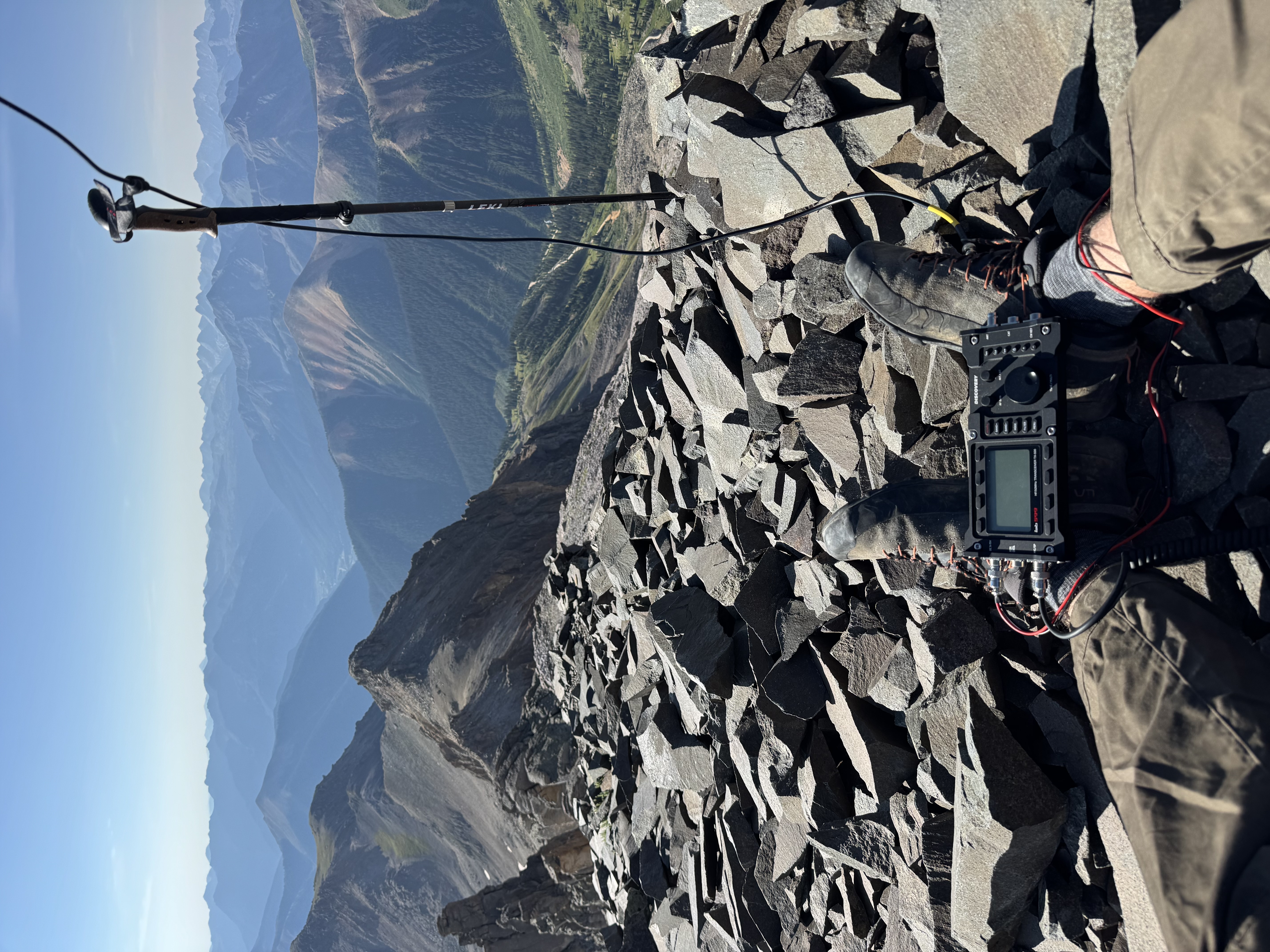
Operating position on Lookout - I had already unplugged the antenna
HF proved more fruitful, and I made the requisite four contacts in a few minutes. I didn’t stick around too long, since clouds were supposed to roll in around noon and I wanted to be on my way down by then.
I headed to the northwest side of the summit where I read about a 4th class downclimb that would gain the ridge, which is where I needed to go to get to Wasatch Mountain. That author called it “highly ’not recommended’”, so it sounded right up my alley. I found the chimney with no problem, and scuttled down it. This is a 4th class section that is very gnarly, and not recommended if you are not comfortable on difficult terrain. This is not a hike, and a helmet and rope might be warranted here.
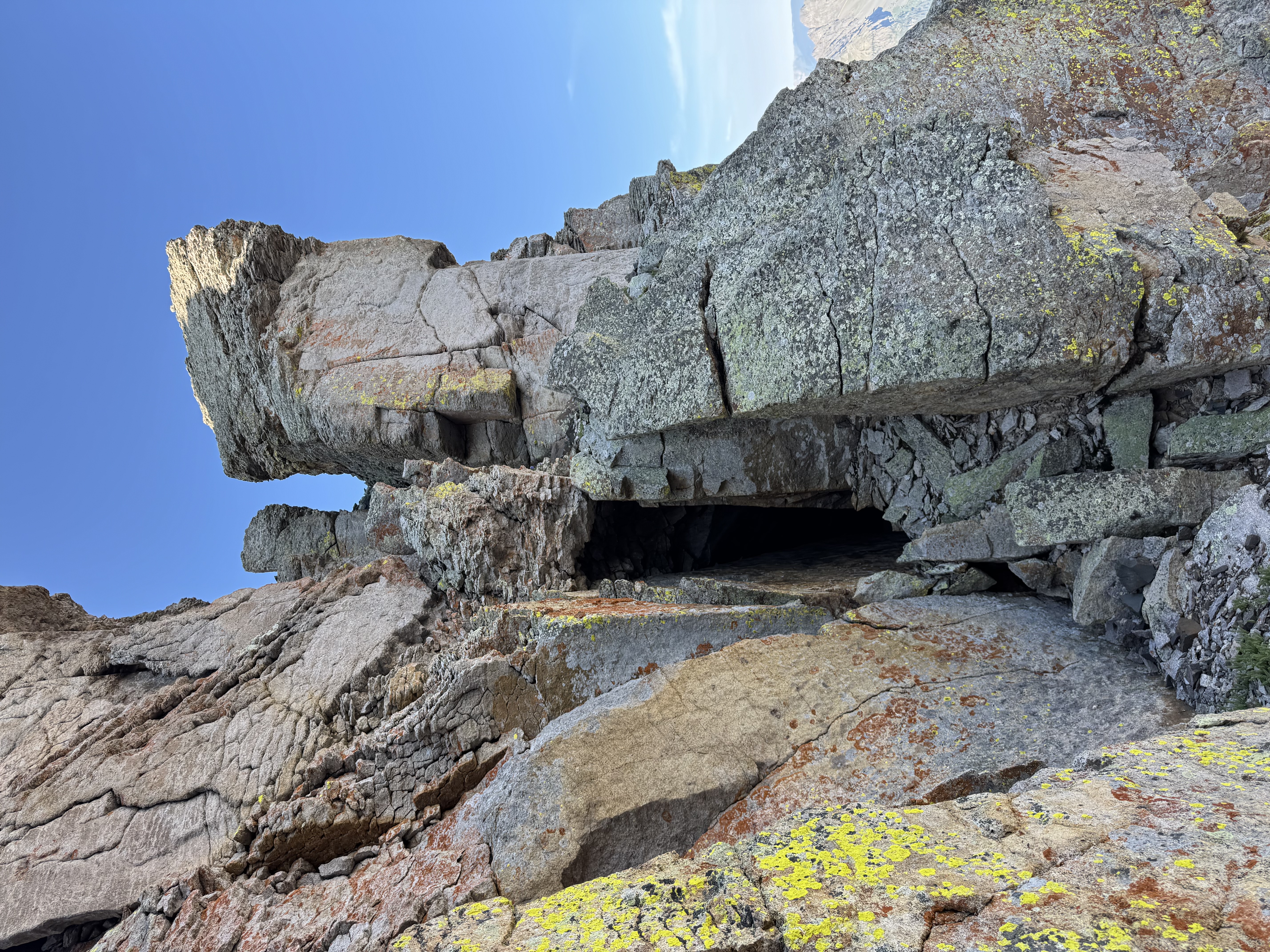
Chimney descent from Lookout Peak on the NW
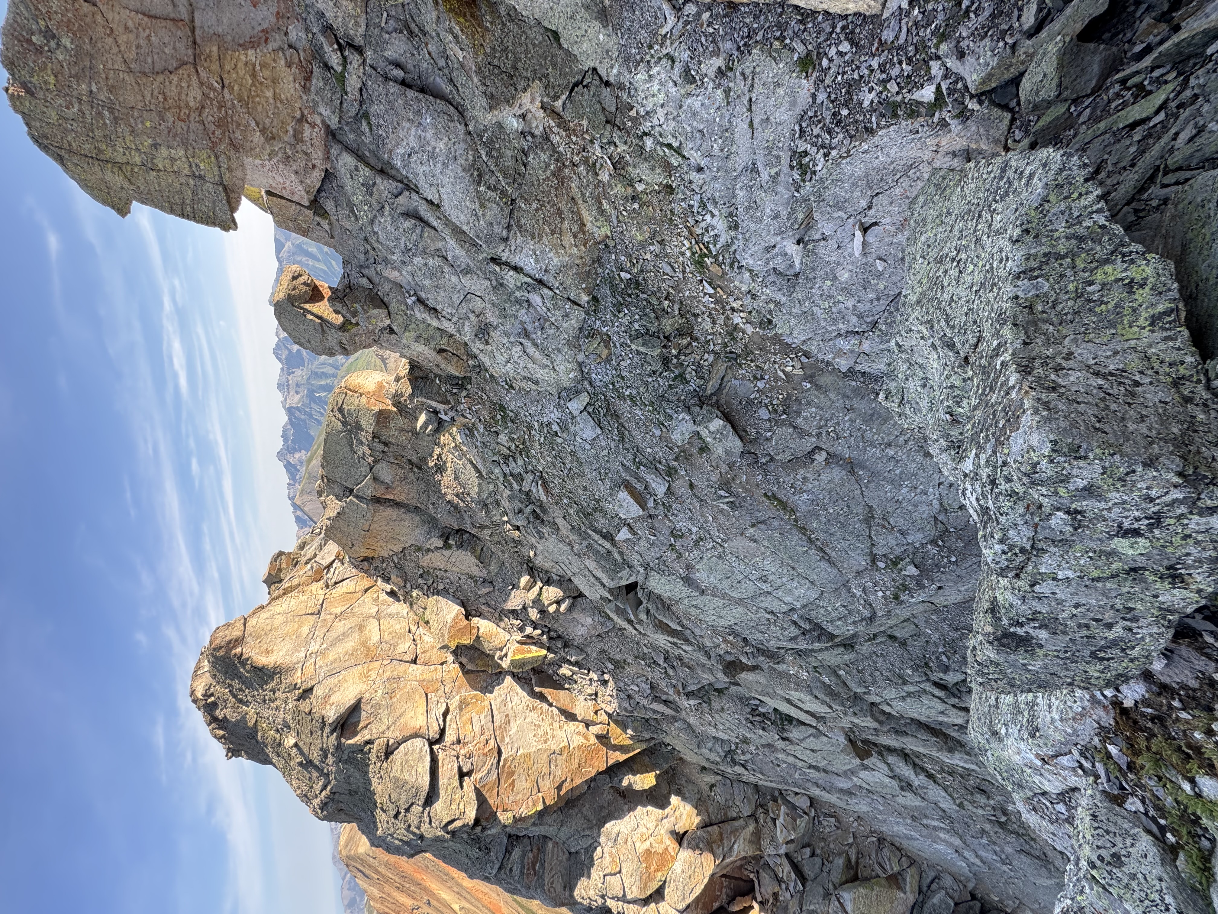
'Trail' leading NW from Lookout
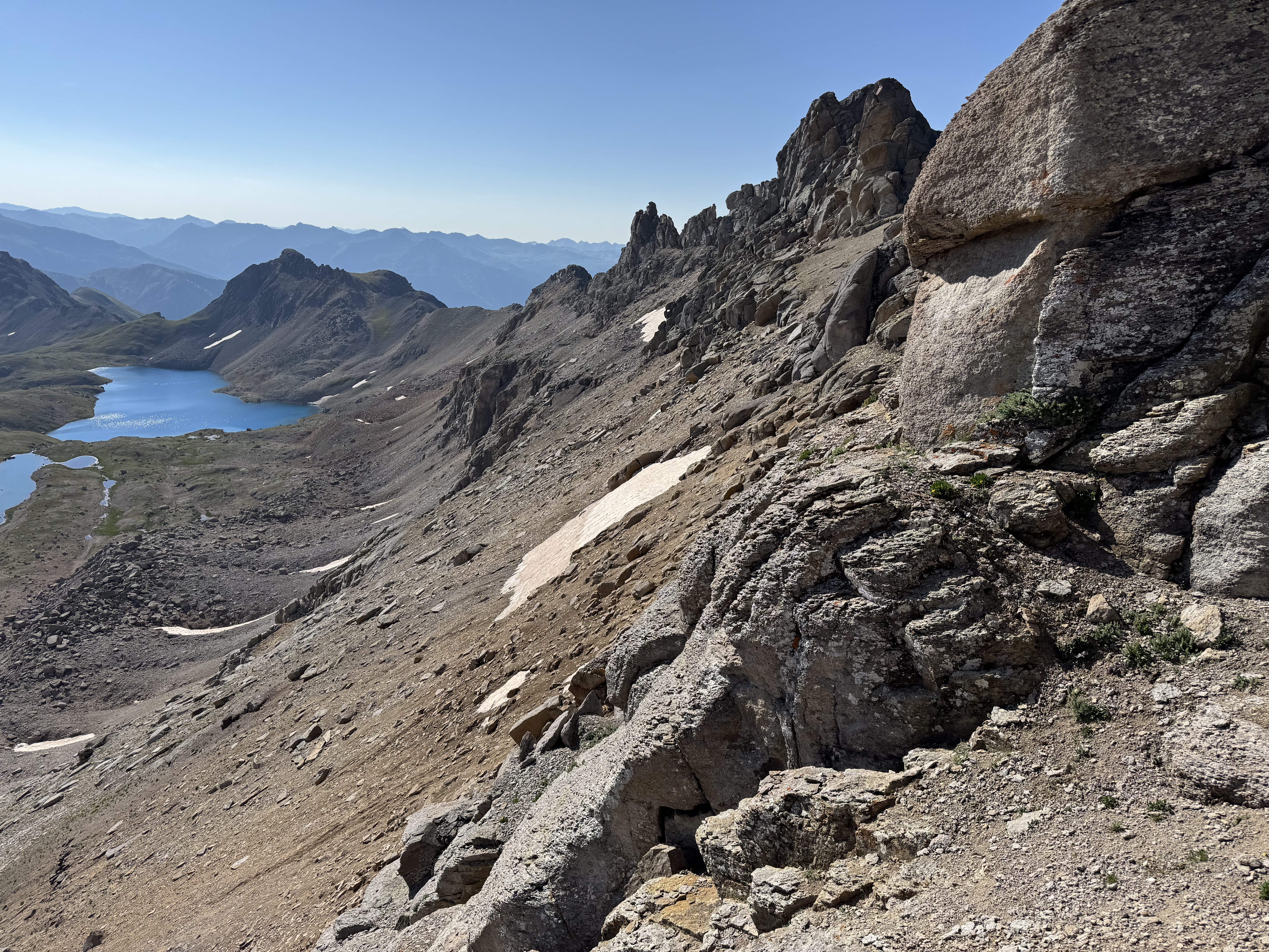
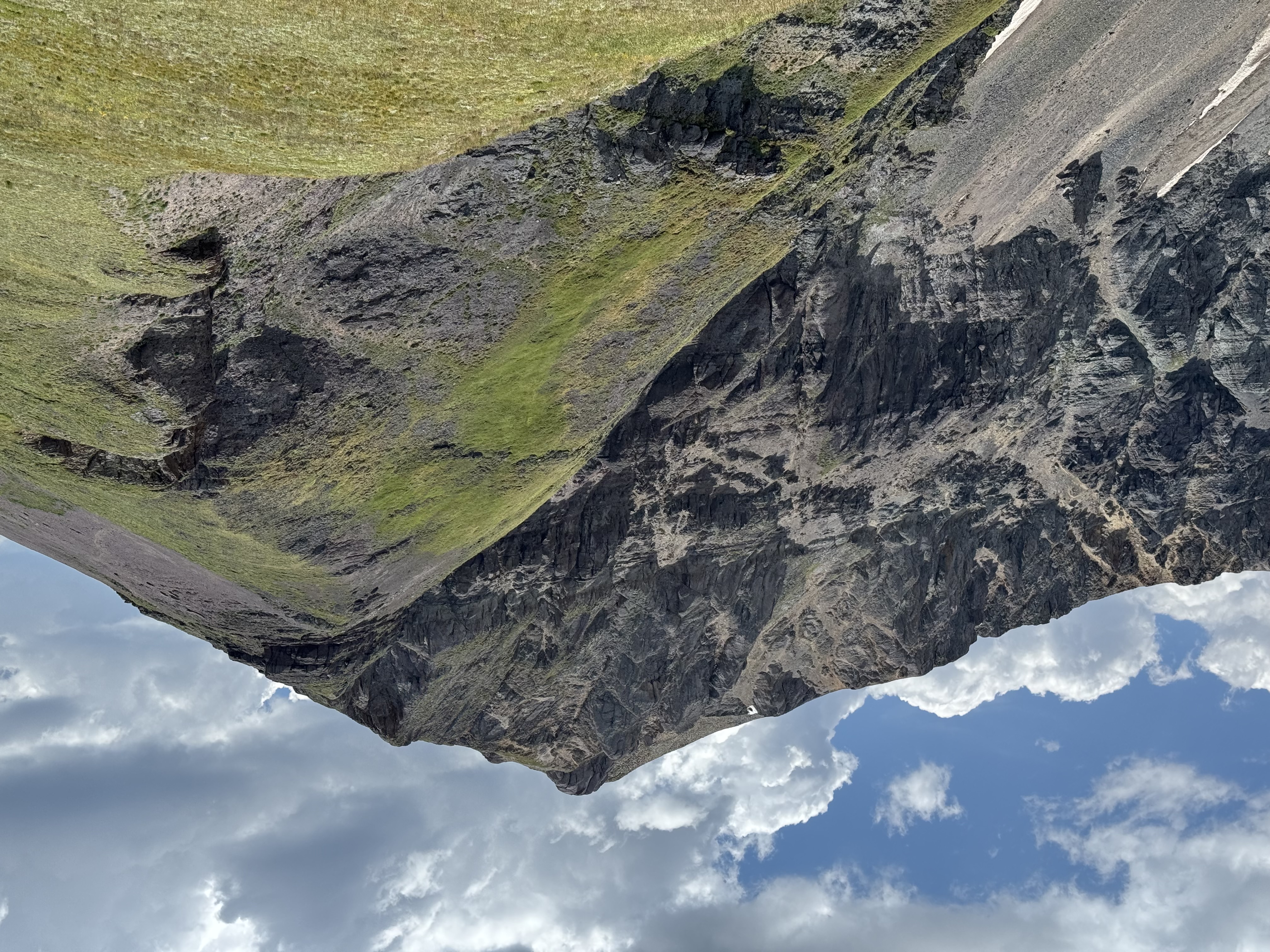
From here there is no defined trail along the ridge to “T12”, an unnamed peak. I picked my way across the ridge as best I could, with a large amount of sliding down scree fields. Again, this is not a hike for the faint of heart or those unfamiliar with reading a map and the terrain ahead.
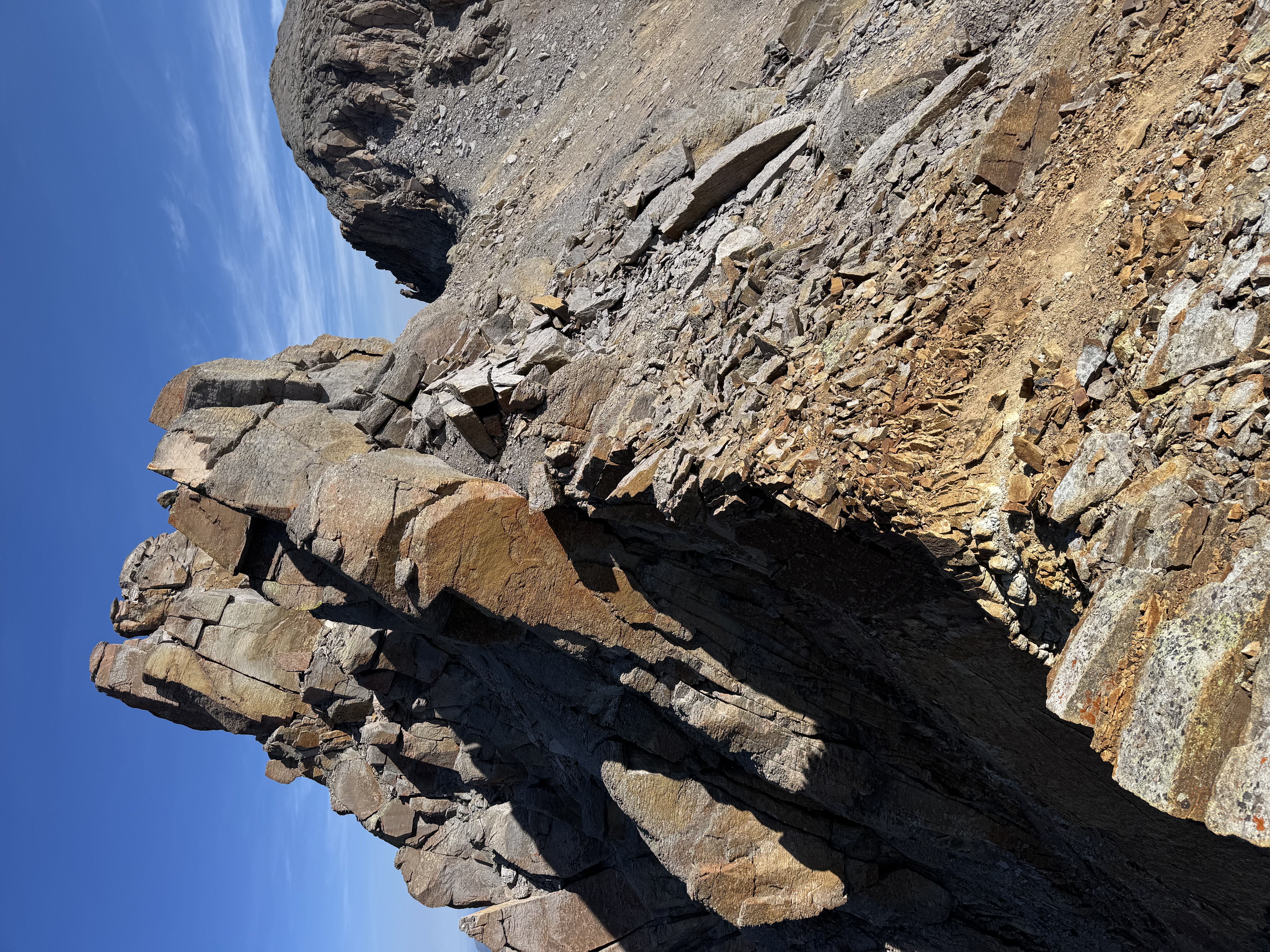
Ridge between Lookout and T12
Scree between Lookout and T12
Columbine Lake and the trail I chose, looking back at Lookout
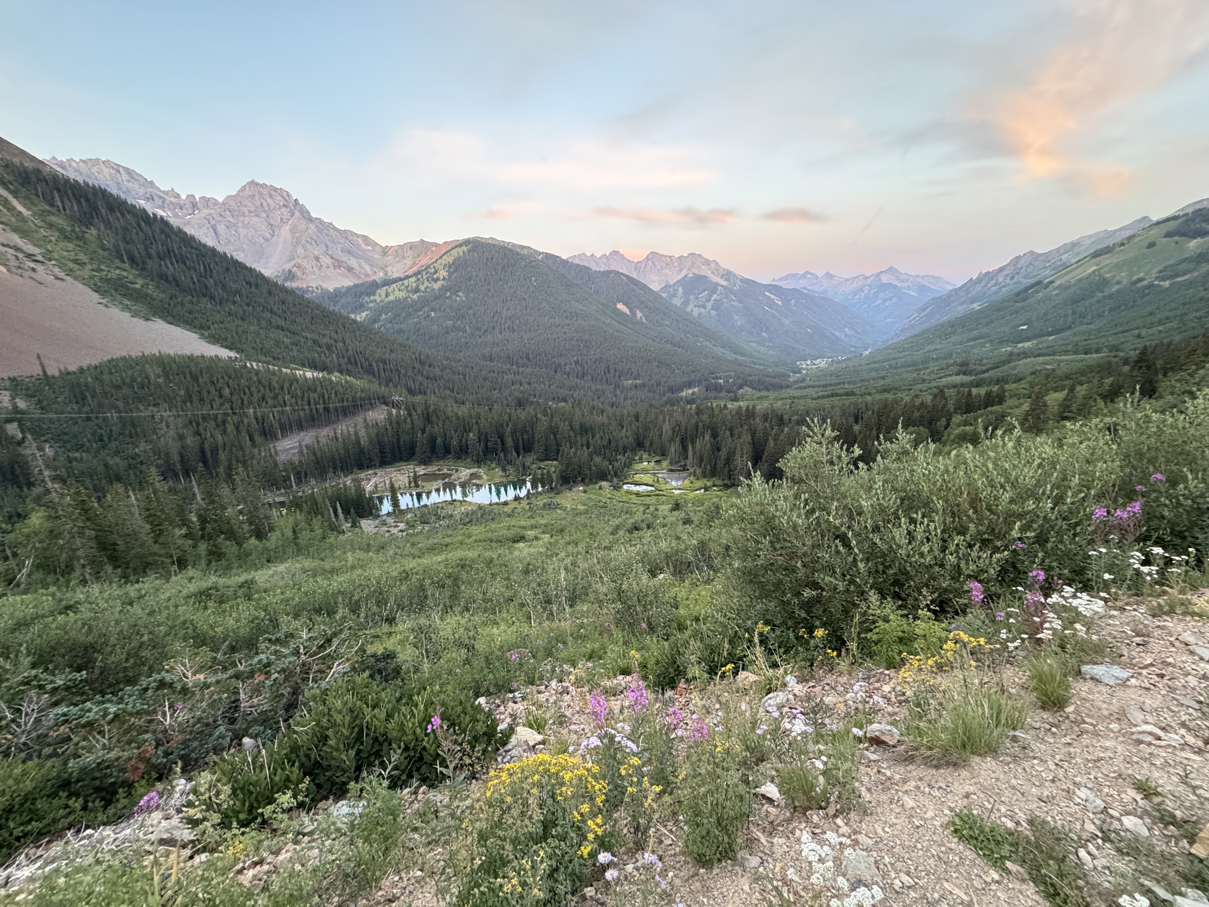
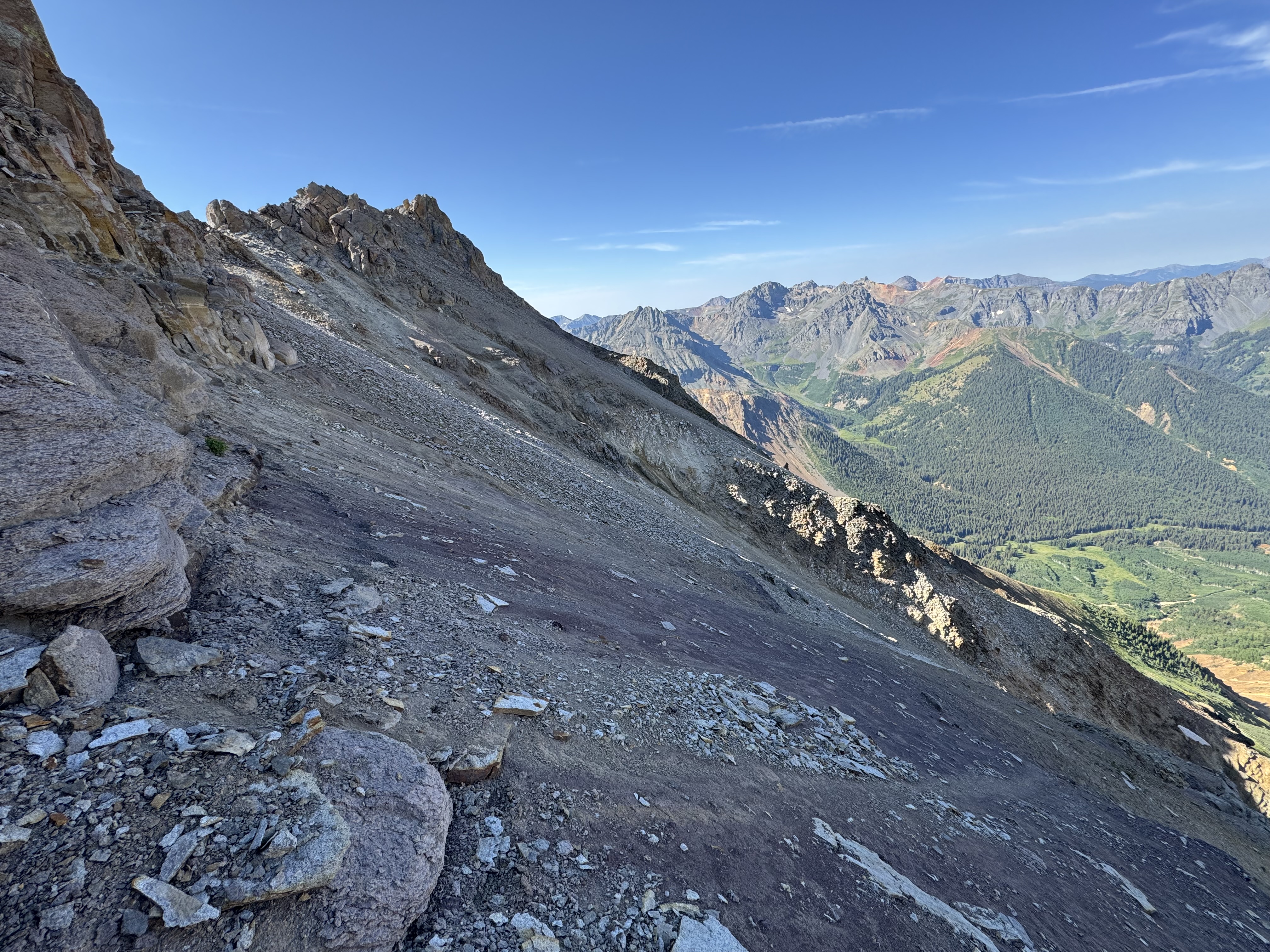
Once I passed T12 the ridge mellowed out considerably, and turned from a scramble back into a hike. I was relieved to reach an old mining road which led to the saddle, and more relieved to find a defined trail up Wasatch Mountain. Phew!
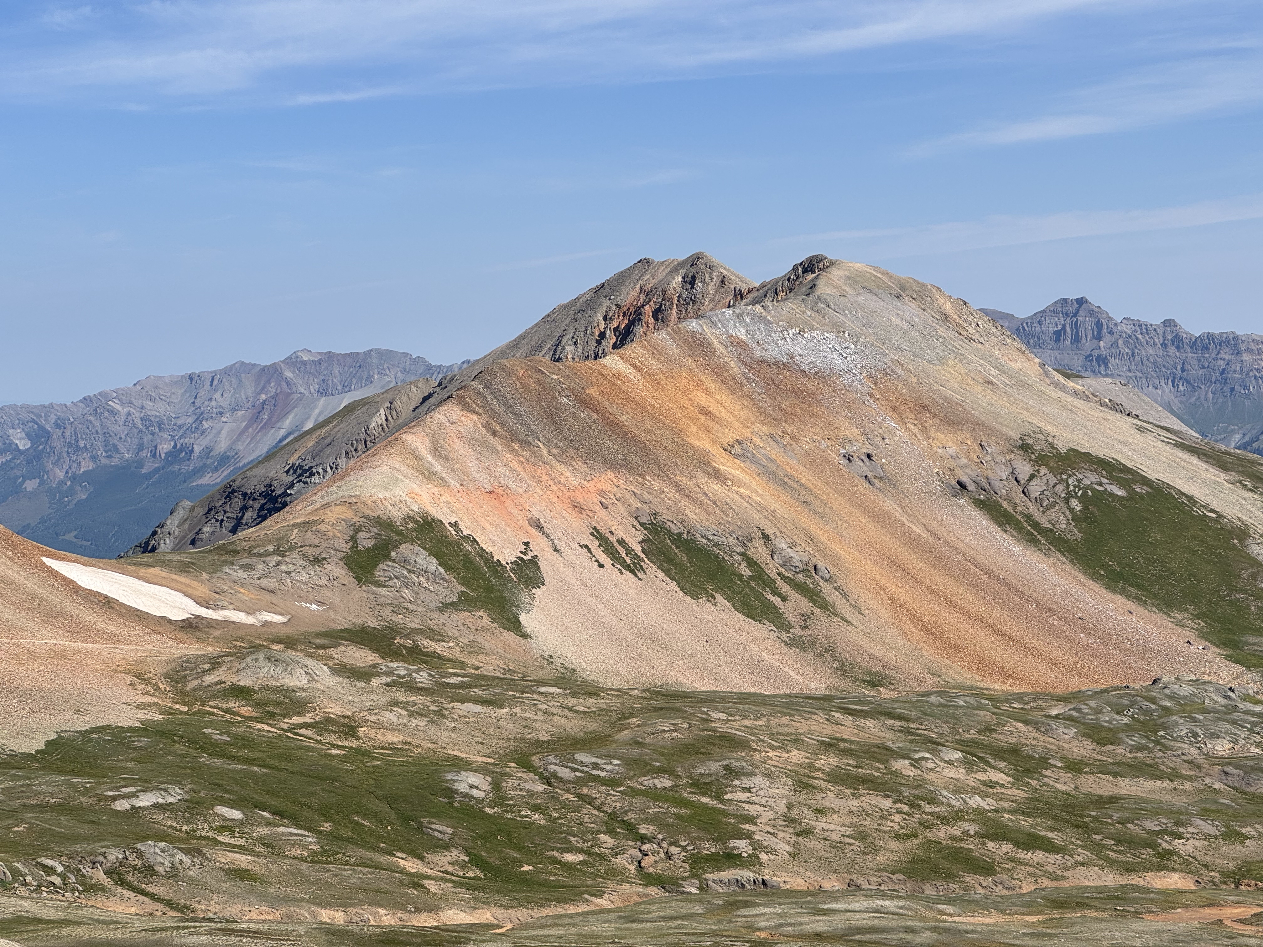
Wasatch Mountain from the South
Makes you think... Looking back to T12
I gained the summit of Wasatch W0C/SJ-173 after about 2 hours of scrambling and hiking, quite a bit longer than I was expecting for the two mile jaunt. I try to err on the side of an earlier start for reasons like this, the mountains throw all kinds of extra adventures at you all the time and it’s better to be safer than sorry.
The summit of Wasatch was nice, and there was another party with me. Ryan offered to take my photo, which I am very appreciative of.
It was around 10:45 when I got on the air, and pulled out the HT first. I immediately heard Bob K0NR and Joyce K0JJW on 146.58, the North American Adventure frequency. Bob was kind enough to work his diplomatic magic and coordinate a QSO with me and Jon KM4PEH over on Pikes Peak. I opened the squelch and pointed the Yagi-Uda at him, and was able to get it! It’s about 165 miles between the summits, so I was very happy to get a signal over the Sangre de Cristo range to him.
After a few more contacts and some calories ingested, the weather looked great at 11:30 still. I conferred with my summit mates and they told me the rain had been pushed back until 3pm from noon, so I decided to pack up and head for La Junta.
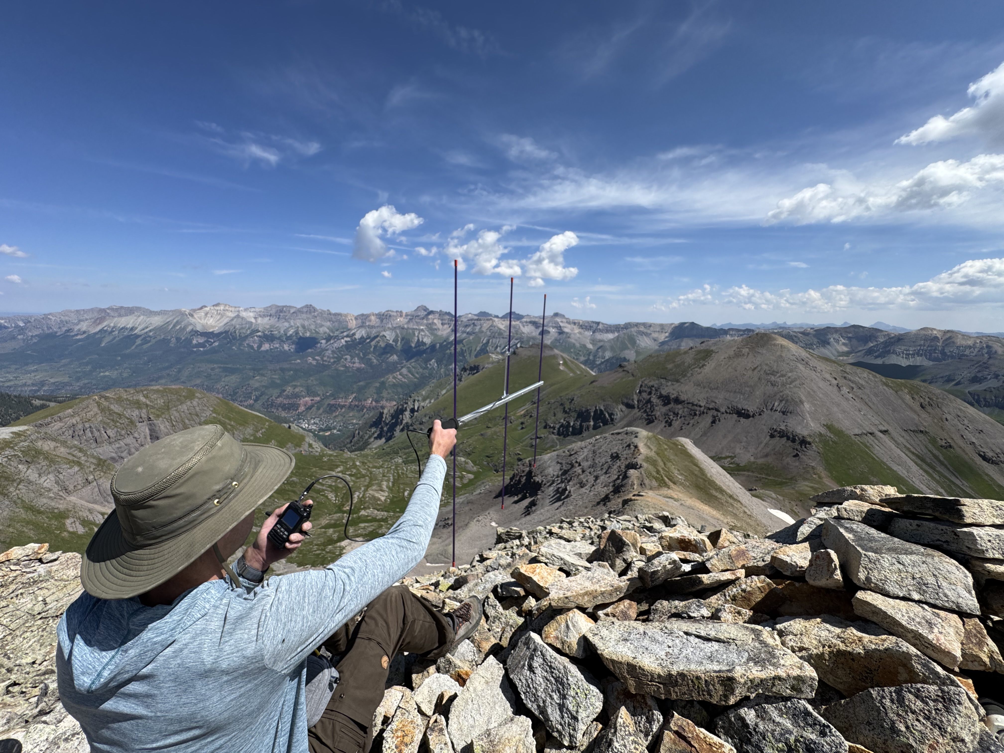
W0ADV working KM4PEH 165 miles away, using a Yagi-Uda antenna
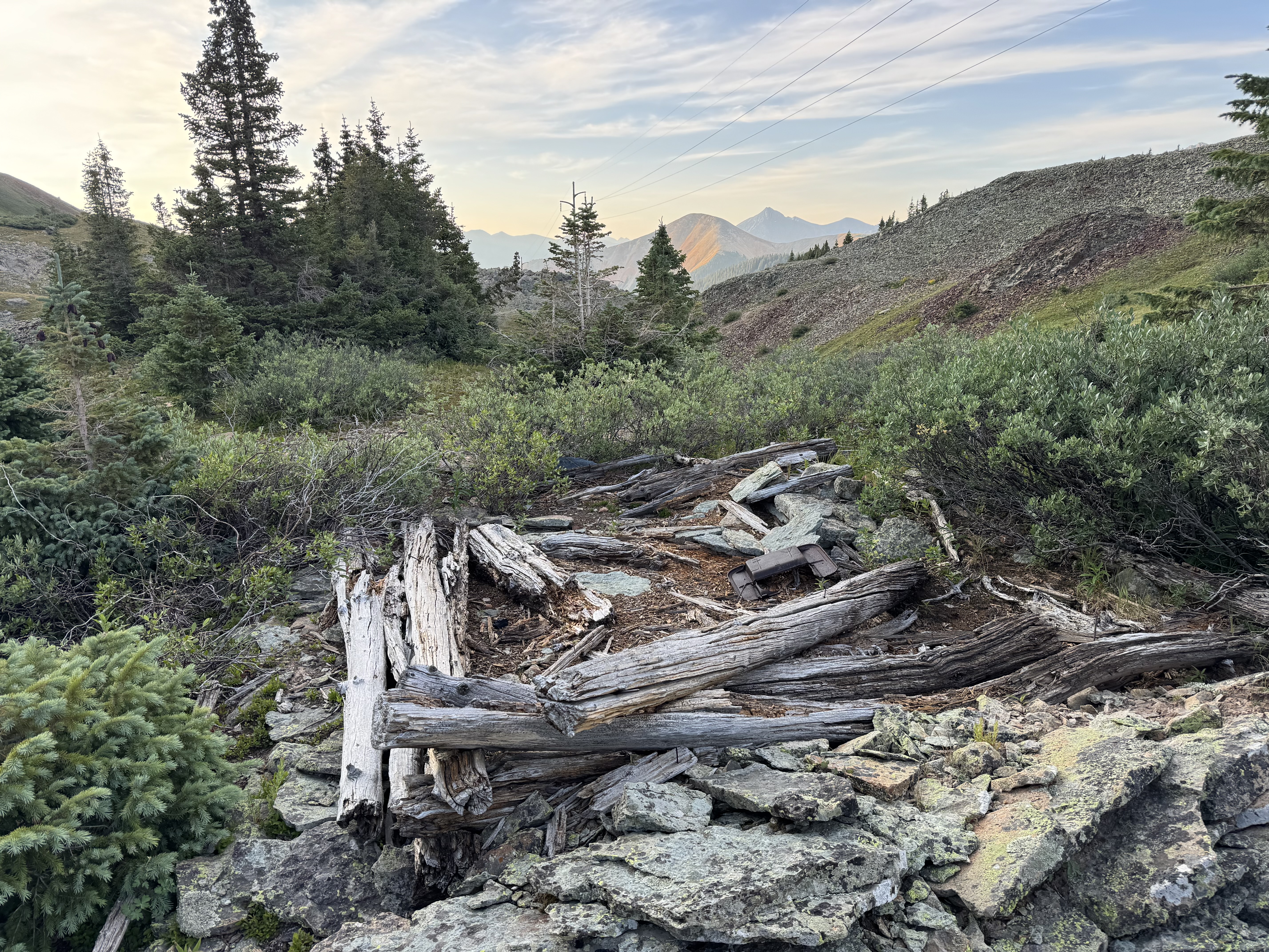
The trail down, over, and up La Junta was mellow, with the saddle dropping to around 12,800.
La Junta Peak, as approached from the south saddle
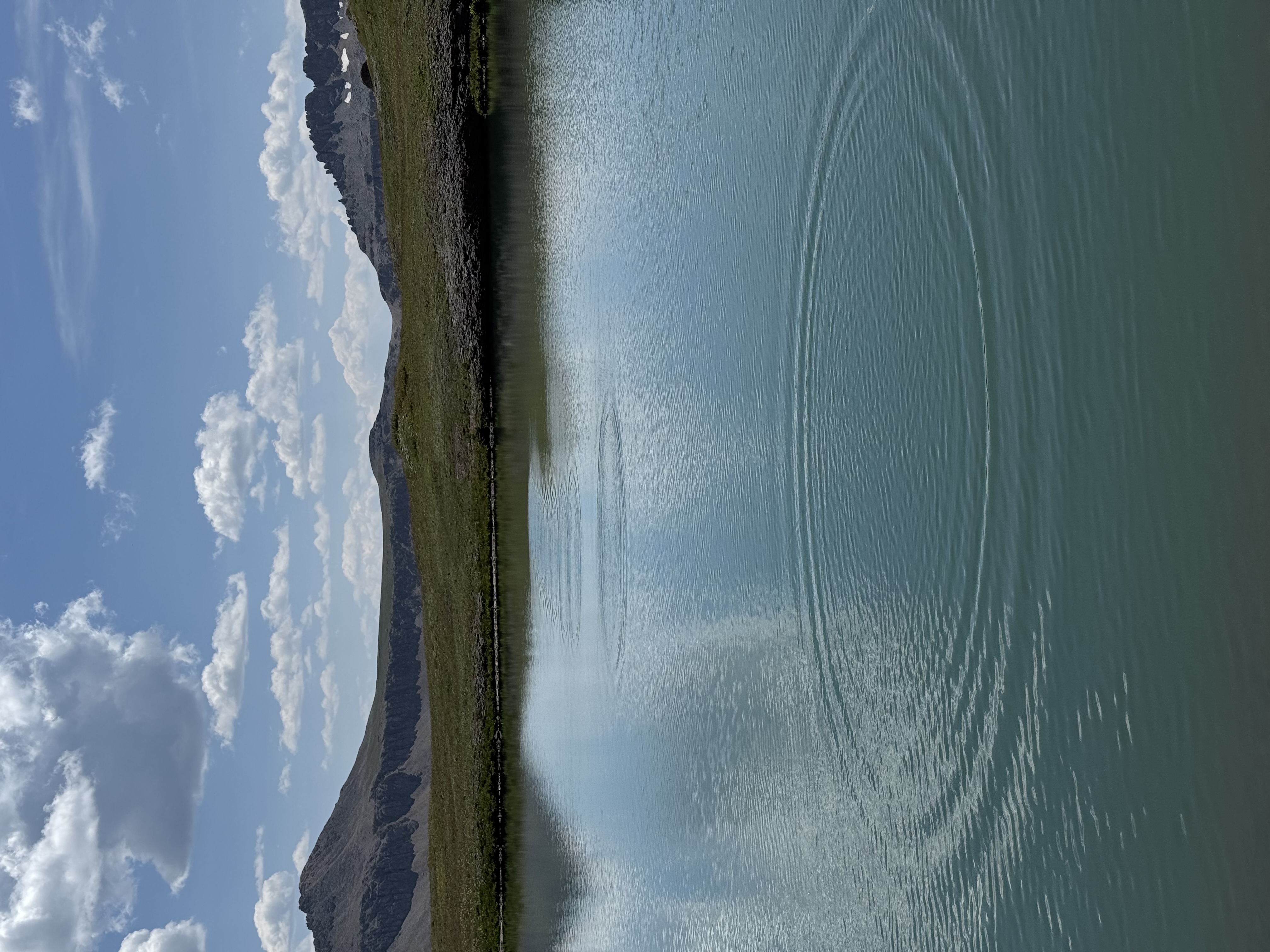
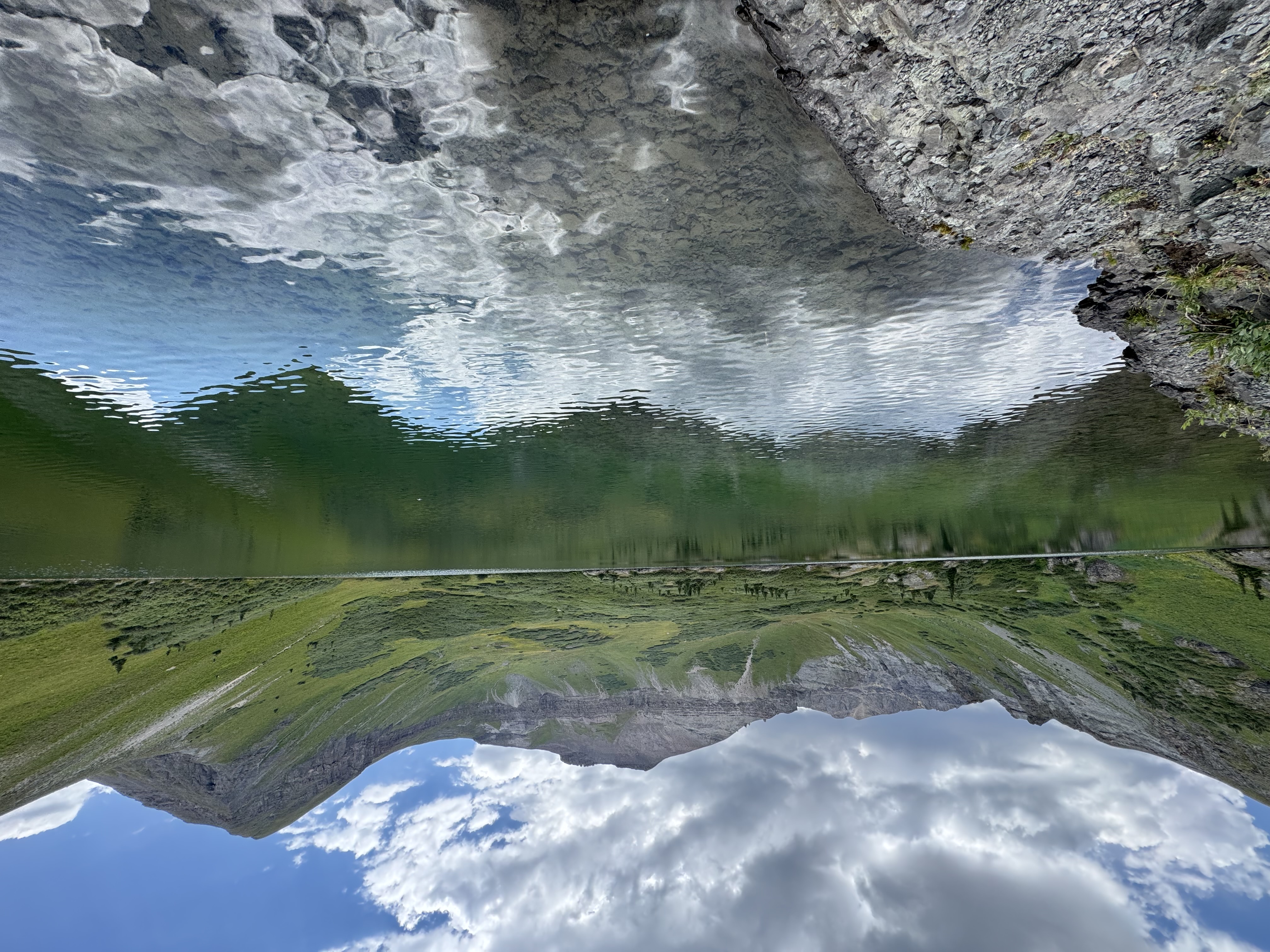
Alpine lake, with a trail of concentric waves visible, as if someone skipped a sone on it...
Trail up La Junta
Clouds were just starting to form and darken as I summited La Junta W0C/SJ-007. I quickly turned on the HT, but it seemed the other summit stations had already cleared out. I waited some minutes, called CQ some more, then got out the HF gear.
Of course the bands were completely dead.
I tried for a while on 20m and was very fortunate to make two contacts from some folks on a summit in Wyoming, as well as another summit to summit in Washington. I could hear the usual chasers, but could not get a signal out to them. I tried again on 40m with even worse luck, so at risk of not making the contacts I fired up the HT again. I was able to make a local contact in Nucla, which I was very appreciative of.
My HF radio buzzed with my callsign from a familiar voice. Carey KX0R jumped on SSB for a change and was calling me with a 5x9 signal from Dakota Hill! I was very grateful to work the legend, and that he was patient enough to find me on 40m.
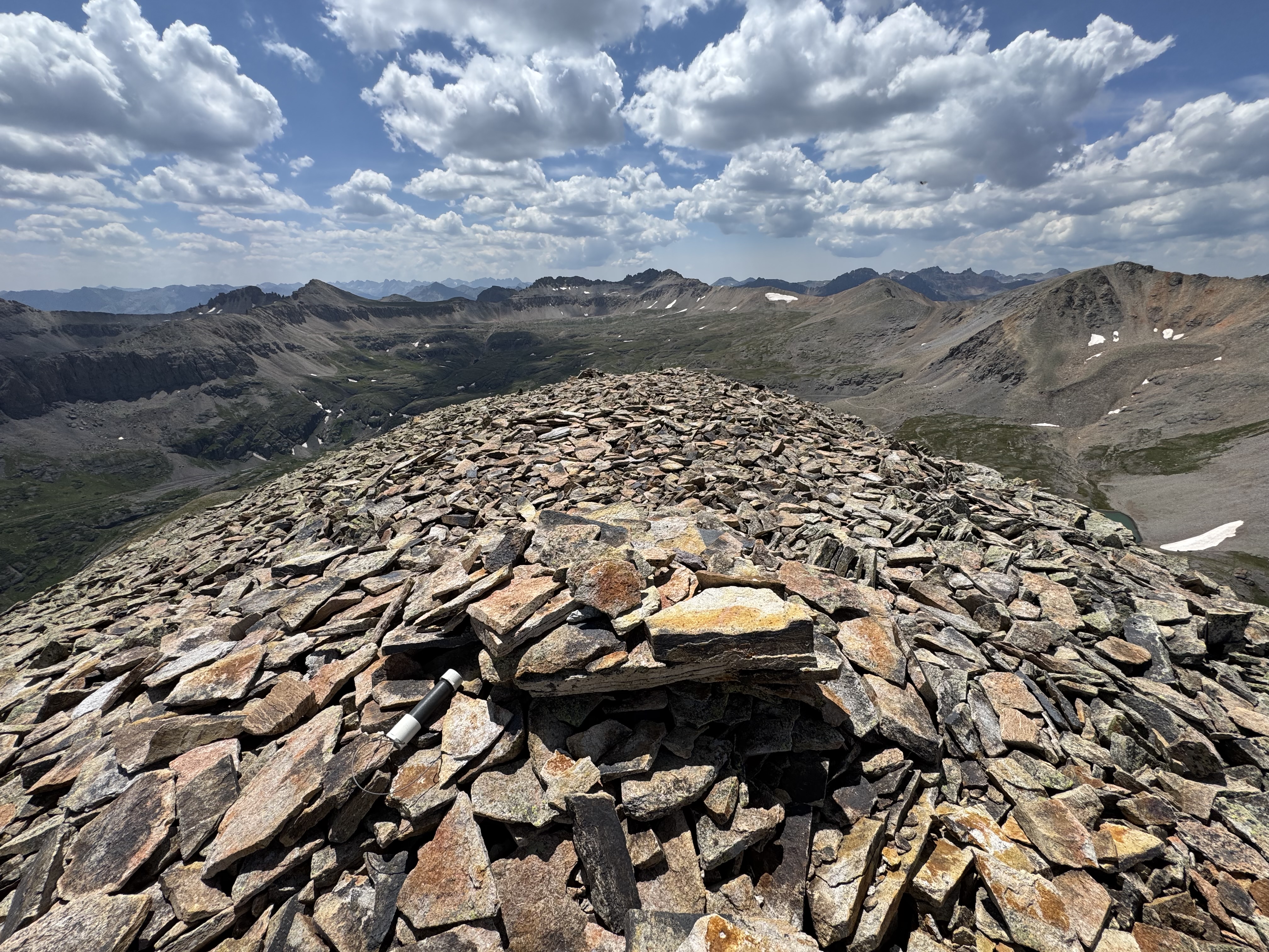
Summit of La Junta
Operating positing on the summit of La Junta
There are several ways to get down from La Junta, and after making a phone call to my lovely wife and ride home from town I decided to go down to Silver Lake, where she would start hiking up to and meet me on the trail. It was a bit more than I was expecting with loose scree and some creative route finding around rock bands, but the views of Telluride were worth the trouble.
La Junta from the west
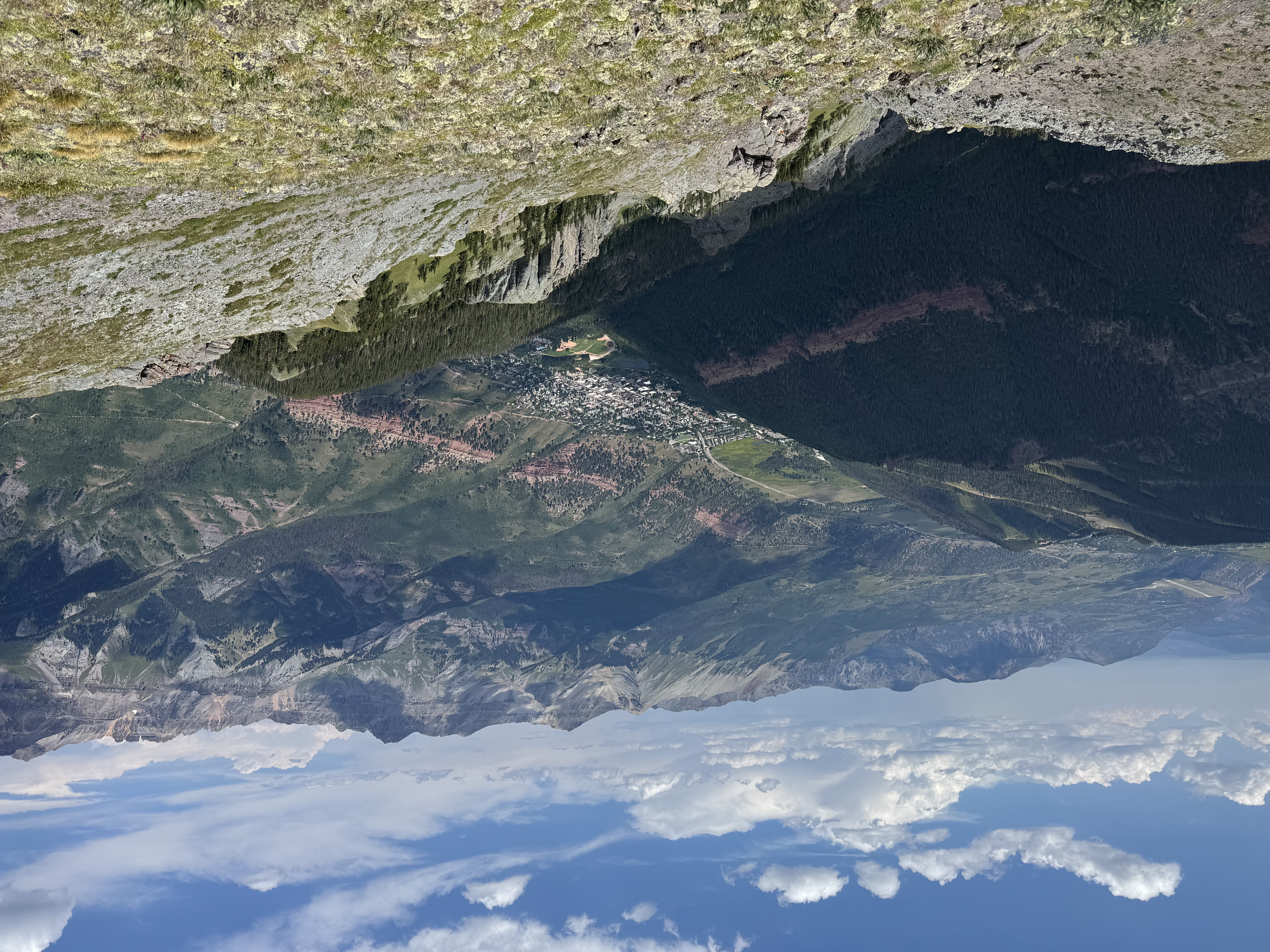
Telluride from just below La Junta
And of course passing by a lake meant I got to dip my toes in and cool off a bit.
Silver Lake
The trail down from the lake is steep, and I was glad to meet my wife a bit above the bridal veil power station. We continued down the switchbacks where a nice group from Texas let us hitch a ride in the back of their 4runner to save our knees on the way into town.
- 10.5 miles point to point, Ophir to Telluride
- 4,500 feet of vertical gain
- 9:50 total time, 6:50 moving time
- Three SOTA summits, highest 13,661'
- GPX Track
- The above should be used for reference only, as there is no official trail and I was off-trail a good amount of time. Use your best judgement.